
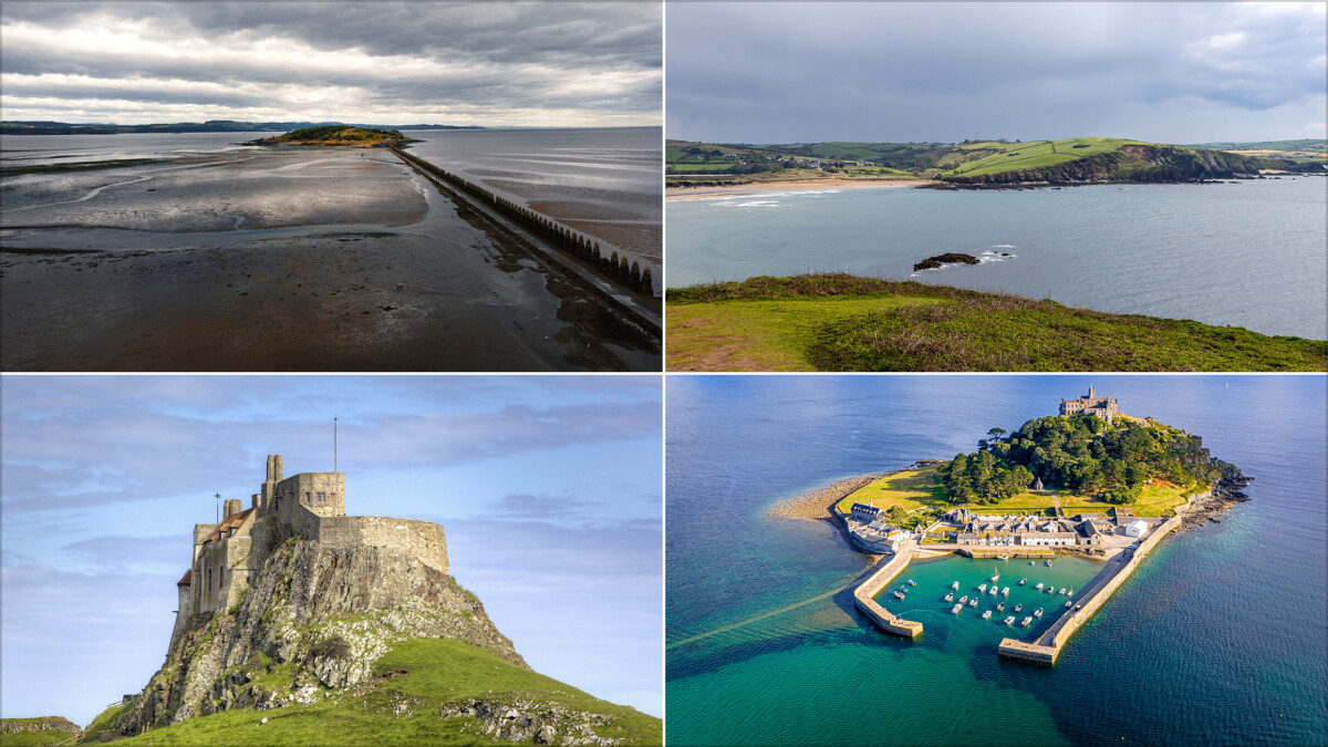
These beautiful islands reveal a path from the mainland at low tide, allowing visitors to walk across a causeway, beach or cobbled track for a few hours each day. The tide is the boss, though: check the official crossing times, leave a generous margin and never try to beat incoming water.
Britain has some particularly good examples, ranging from castle-topped islets in Cornwall to quiet archaeological sites in Orkney. A tidal crossing can be a memorable part of a trip, but it is also a practical transport arrangement with a fairly unforgiving timetable.
How Tidal Island Crossings Work
A tidal island is cut off by the sea at high tide and connected to the mainland when the water recedes. The exposed route may be a surfaced causeway, a shingle beach, sand, mud or rough rock, so conditions vary far more than the phrase “walkable at low tide” suggests.
Safe crossing windows are shorter than the full period of low tide. Water can cover a route quickly, and tide times differ by location. Wind, waves, rain and poor visibility can also make a crossing unsuitable even when a timetable suggests the route should be open.
- Use the destination’s official tide timetable or local signage, not a general weather app.
- Cross early in the published window and plan to return well before it closes.
- Wear footwear with grip that can cope with wet, uneven ground.
- Carry a charged phone, but do not rely on phone signal to solve a poor timing decision.
- Keep children and dogs close, particularly near fast-moving water and slippery rock.
1. St Michael’s Mount, Cornwall
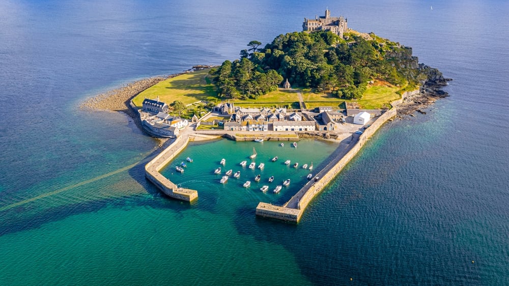
St Michael’s Mount sits in Mount’s Bay near Marazion, with a medieval castle and gardens rising above the harbour village. At low tide, visitors can walk the granite causeway from Marazion; at other times, the island is reached by boat when services are running.
The National Trust’s St Michael’s Mount page publishes access information and opening details. The causeway is uneven and can be slippery, so this is a crossing for sturdy shoes, not flimsy sandals bought for a beach lunch.
Good to know: access to the island, castle and garden can have different arrangements, and some areas operate with timed entry. Check the day’s information before setting off from Marazion.
2. Holy Island of Lindisfarne, Northumberland
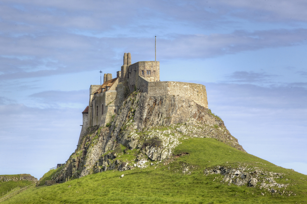
Holy Island is one of Britain’s best-known tidal destinations, linked to the Northumberland coast by a road causeway. Lindisfarne Priory, the village, harbour and castle make it a full day out, but the crossing schedule needs to shape the whole plan.
The road is covered by the North Sea twice daily. Do not drive or walk across outside the signed safe crossing times. Vehicles caught by the tide are a regular enough problem that refuge towers stand alongside the causeway, though they are for emergencies, not a viewing platform. Conditions near Belford were 61F (16C), with few clouds and 90% humidity (as of September 2026), which is a useful reminder that a mild-looking day can still feel damp and exposed on the causeway.
Use the official Holy Island safe crossing times supplied by Northumberland County Council. Build in time for parking, traffic and a meal before you need to leave; treating the final crossing time as a target is a poor plan.
3. Burgh Island, Devon
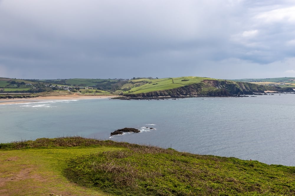
Burgh Island lies just off Bigbury-on-Sea in south Devon and is joined to the beach by a short sandy causeway at low tide. It is widely recognised for its Art Deco hotel and the sea tractor that carries hotel guests and visitors across when the tide covers the route.
The walk is straightforward in settled conditions, but sand and shallow water are still affected by the tide. Check local conditions before arriving, especially after rough weather. Public access to parts of the island is limited, so view the crossing as part of a coastal walk rather than assuming every building and path is open to day visitors.
4. Cramond Island, Edinburgh
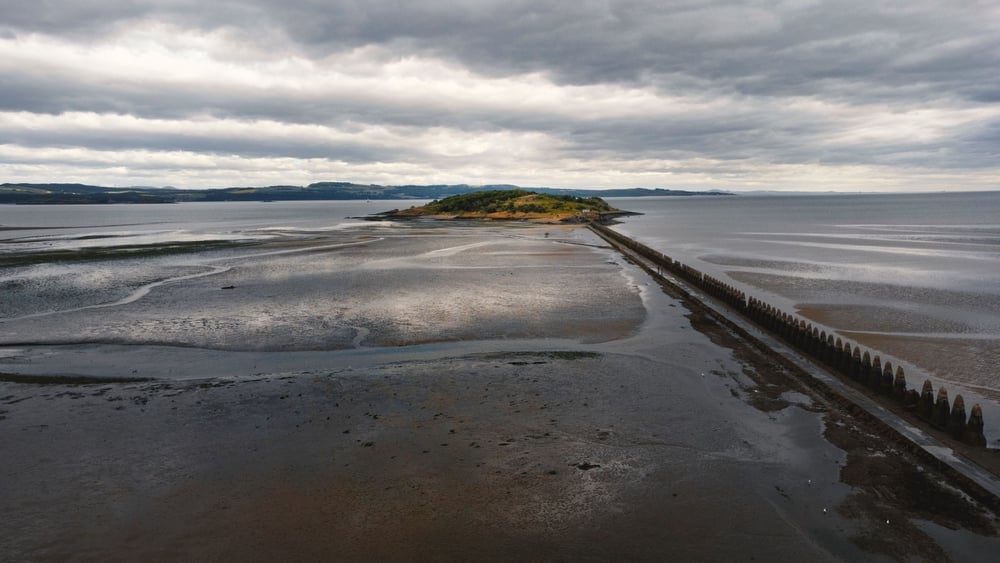
Cramond Island is reached across a long concrete causeway from the village of Cramond, north-west of central Edinburgh. The walk passes the striking line of Second World War anti-boat barriers, while the island itself has remnants of military buildings and wide views across the Firth of Forth.
The route is exposed, and the Firth’s water does not hang about. The City of Edinburgh Council advises visitors to check tide times and states that the causeway is passable only for a limited period around low tide. Follow the council’s Cramond Island guidance, including its safety advice, before making the walk.
Cramond makes an easy addition to a city break if you have a car or are happy to use local buses, although the timetable may dictate when you can arrive and leave. Visitors looking for more coastal escapes can also compare these Scottish islands to visit, many of which require ferries rather than a race against the tide.
5. Brough of Birsay, Orkney
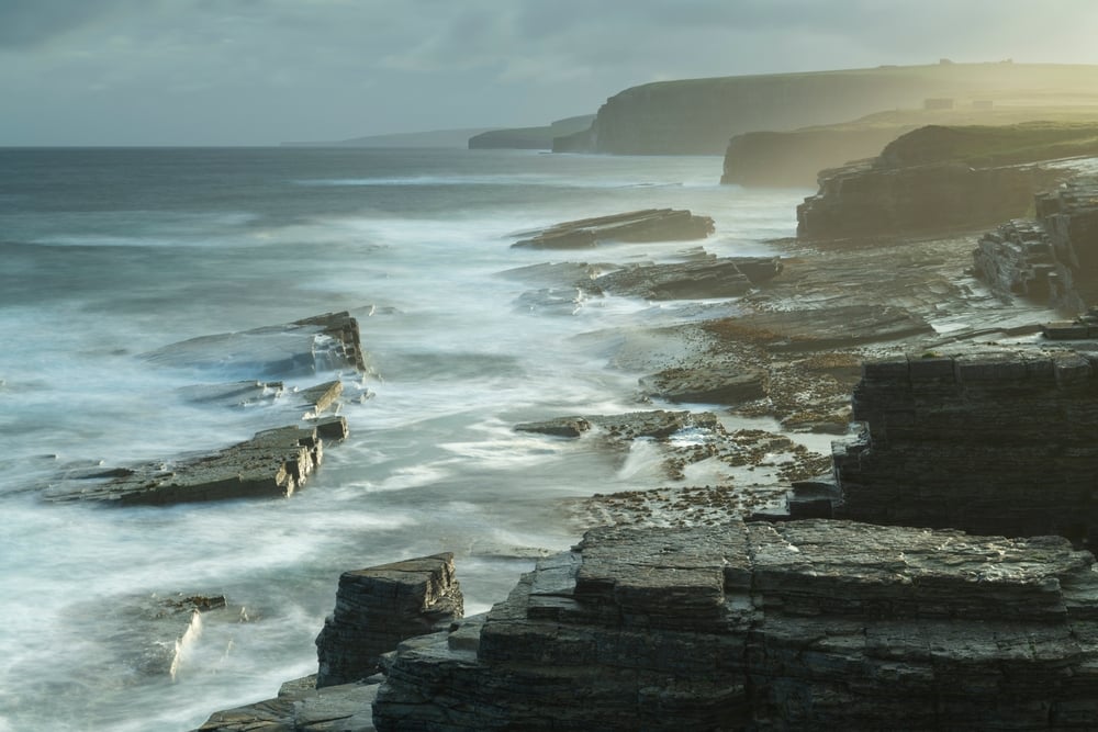
The Brough of Birsay is a small tidal island on Orkney’s west coast, connected to the mainland by a rough stone-and-concrete causeway. The reward for timing it well is substantial: the island contains Norse and Pictish settlement remains, a lighthouse and dramatic cliff-edge views.
Historic Environment Scotland manages the site and warns that the causeway is covered at high tide. Check the Brough of Birsay visitor information and local tide boards on the day. Strong winds are common in Orkney, and the crossing is much less appealing when spray is coming sideways.
The Brough works well on a wider self-drive circuit of Orkney Mainland. Allow time for the nearby village of Birsay and Skara Brae, but keep the crossing window fixed in your itinerary.
6. Llanddwyn Island, Anglesey
Llanddwyn Island, or Ynys Llanddwyn, lies at the south-western edge of Anglesey and is reached by walking across Newborough Warren and its beach. It is associated with Saint Dwynwen, Wales’s patron saint of lovers, and has the remains of a church, cottages and a lighthouse.
The access route is often described as tidal, although visitors should also pay attention to weather, beach conditions and local notices. Natural Resources Wales manages Newborough National Nature Reserve and Forest, where parking capacity can be a bigger issue than the walk itself during busy periods. Check the official Newborough visitor information before travelling.

7. St Ninian’s Isle, Shetland
St Ninian’s Isle is connected to mainland Shetland by a long sand tombolo, a natural sand bar with sea on both sides. The wide beach is the main attraction, along with coastal walks and the site’s association with the St Ninian’s Isle Treasure, a collection of early medieval silver found in 1958.
Unlike a paved causeway, a tombolo can feel exposed even when dry. Check local weather and tide information, and avoid walking over if the sea is rough or visibility is poor. The route is best suited to visitors with a car, as Shetland’s distances and public transport need more planning than a quick map glance suggests.
8. Chapel Island, Cumbria
Chapel Island sits off the Furness Peninsula in Morecambe Bay, an area known for vast tidal flats and rapid incoming tides. It has historical interest and coastal views, but this is not a casual independent beach walk.
Morecambe Bay has dangerous channels, mud and fast-moving tides. Access to islands and crossings in the bay should only be considered with appropriate local knowledge or an organised, authorised crossing where available. The famous bay crossings led by the King’s Guide are a useful reminder that local route knowledge can be a safety requirement, not a nice extra.
What To Pack for a Low-Tide Island Walk
Most tidal island walks are short, but wet surfaces, loose stones and sudden weather are common. Pack for the route you will actually walk, not for the postcard version of it.
- Waterproof walking shoes or boots with decent grip.
- A waterproof layer and warm mid-layer, even in summer on northern coasts.
- Water, snacks and any medication you may need before returning.
- A fully charged phone and an offline map of the area.
- A printed or saved copy of the official crossing times.
No products found.
How To Plan a Tidal Island Visit
- Choose the island first. Check that public access is permitted and that the site is open on your chosen date.
- Find the official crossing timetable. Use the route-specific safe-crossing times where they are published.
- Plan your arrival around the first part of the available window, allowing for parking and the walk to the causeway.
- Set an alarm for your return time. Allow extra time if you want to visit a café, attraction or viewpoint.
- Check wind and weather on the morning of the visit, then change plans if conditions look poor.
For a longer driving holiday, low-tide stops work best as one planned part of the day, with a flexible alternative nearby. Scotland’s coast has plenty of routes that do not depend on the sea behaving itself, including several Scotland campervan routes that can be adjusted around weather and ferry timings.
Frequently Asked Questions
Can You Get Stranded on a Tidal Island?
Yes. A rising tide can cover the only route back to the mainland, leaving visitors stranded for hours or putting them at immediate risk if they try to cross. Follow official safe-crossing times and return early.
Is It Safe To Walk to an Island at Low Tide?
It can be safe on a recognised route when you follow official guidance, use appropriate footwear and cross within the published window. It is unsafe to improvise a route across mudflats, channels or unknown beaches.
Which Tidal Island Is Easiest To Visit?
St Michael’s Mount and Holy Island of Lindisfarne are among the easiest for first-time visitors because they have established visitor facilities and published access information. Both still require close attention to the tide schedule.
Can You Drive Across a Tidal Causeway?
Some tidal causeways, including the route to Holy Island, carry vehicles during official safe crossing times. Never drive into standing water or use a causeway after it has closed, even if the water looks shallow.