
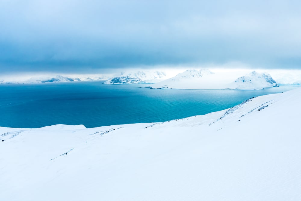
The Tibetan Plateau is the world’s biggest high plateau, at roughly 2,500,000 square kilometres and an average height above 4,500 metres. The Antarctic Plateau is also enormous, but it is ice-covered and its area estimates vary, so Tibet takes the title for most readers.
This guide ranks the world’s biggest plateaus on the figures that can be checked, explains why the numbers differ between sources, and covers which ones you can visit, how high you will be, and what that does to your body on arrival.
Which Is the World’s Biggest Plateau?
On area and height together, the Tibetan Plateau, at about 2,500,000 square kilometres, is the largest and the highest. It stretches about 2,500 kilometres east to west and 1,000 kilometres north to south, and it holds the headwaters of the Yangtze, Yellow and Mekong rivers.
Not every source agrees on the size. Guinness World Records lists the Tibetan Plateau as the most extensive high plateau, at 1,850,000 square kilometres with an average altitude of 4,900 metres. Sources draw the plateau’s boundary differently, so the figures differ. This guide uses the 2,500,000 figure for the area and treats the Guinness number as a lower estimate.
The Antarctic Plateau is the awkward entry. Area estimates for it vary widely between sources, so no single figure appears in the ranking below. What is consistent is its height: an average elevation of about 3,000 metres and a diameter of roughly 1,000 kilometres.
World’s Biggest Plateaus at a Glance
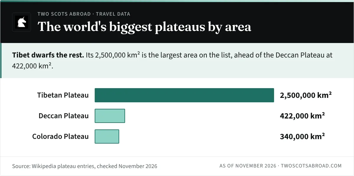
This table puts the five plateaus side by side. Where a source does not give a figure, the cell says so.
Switch between area and average height to see how the plateaus compare.
| Plateau | Where | Area | Average height | Can you visit? |
|---|---|---|---|---|
| Tibetan Plateau | China, plus parts of India, Nepal and neighbours | 2,500,000 km² | Above 4,500 m | Yes, via Lhasa |
| Antarctic Plateau | East Antarctica | Estimates vary | About 3,000 m | Expedition only |
| Altiplano | Bolivia, Peru, Chile, Argentina | Not given in our sources | About 3,750 m | Yes, via La Paz or Puno |
| Deccan Plateau | Western, central and southern India | 422,000 km² | About 600 m | Yes, via Bengaluru, Hyderabad or Pune |
| Colorado Plateau | Utah, Arizona, Colorado, New Mexico | 340,000 km² | 1,500 to 3,350 m | Yes, nine national parks |
Tibetan Plateau: The Biggest and Highest
The Tibetan Plateau sits between the Himalayas to the south and the Taklamakan Desert to the north. It covers most of the Tibet Autonomous Region and Qinghai in China, plus parts of Sichuan, Gansu, Xinjiang and Yunnan, and reaches into India, Pakistan, Nepal, Bhutan, Afghanistan, Tajikistan and Kyrgyzstan. Mount Everest, at 8,849 metres, stands on its southern edge.
The plateau holds the headwaters of the Yellow, Yangtze and Mekong, and the Indus rises on its western side near Lake Manasarovar. Its ice fields store the largest freshwater reserve outside the polar regions, which is why it is nicknamed the “Third Pole”.
It exists because India is still pushing into Eurasia, and the plateau is still rising by about 5 millimetres a year. The Changtang region in the north averages over 5,000 metres, and winter temperatures there often fall below -35 °C. Annual precipitation across the north and northwest is only 100 to 300 millimetres, so the plateau is cold and dry.
Most visitors reach it through Lhasa, which sits at about 3,650 metres. The Qinghai-Tibet Railway, the world’s highest railway by elevation, has run since 2006 and links Lhasa with Xining, about 2,000 kilometres away. Direct trains from Beijing take around 40 hours. Foreign visitors also need a Tibet Travel Permit, arranged through a licensed tour operator, and you cannot travel around Tibet without a guide. Rules change, so check current entry requirements with an official source before you book.
Antarctic Plateau: Big, Cold and Empty
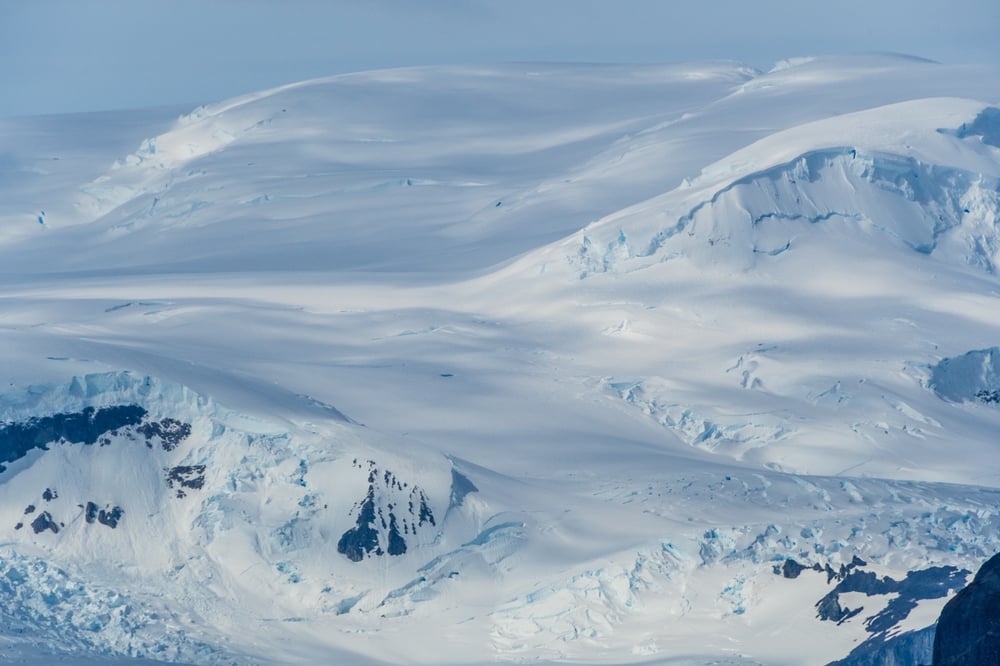
The Antarctic Plateau, also called the Polar Plateau, includes the geographic South Pole and extends over a diameter of about 1,000 kilometres. Its surface is ice, and the temperature there can drop as low as -92 °C.
It was first sighted in 1903 during Robert Falcon Scott’s Discovery Expedition. Ernest Shackleton crossed parts of it in 1909 and turned back about 180 kilometres from the Pole, and Roald Amundsen named it the King Haakon VII Plateau in December 1911. It was first photographed from the air in 1929 on a flight led by Richard E. Byrd.
The East Antarctic ice sheet beneath it has an average thickness of around 2.2 kilometres. Visiting means a polar expedition or a research programme.
Altiplano: The Biggest High Plateau Outside Tibet
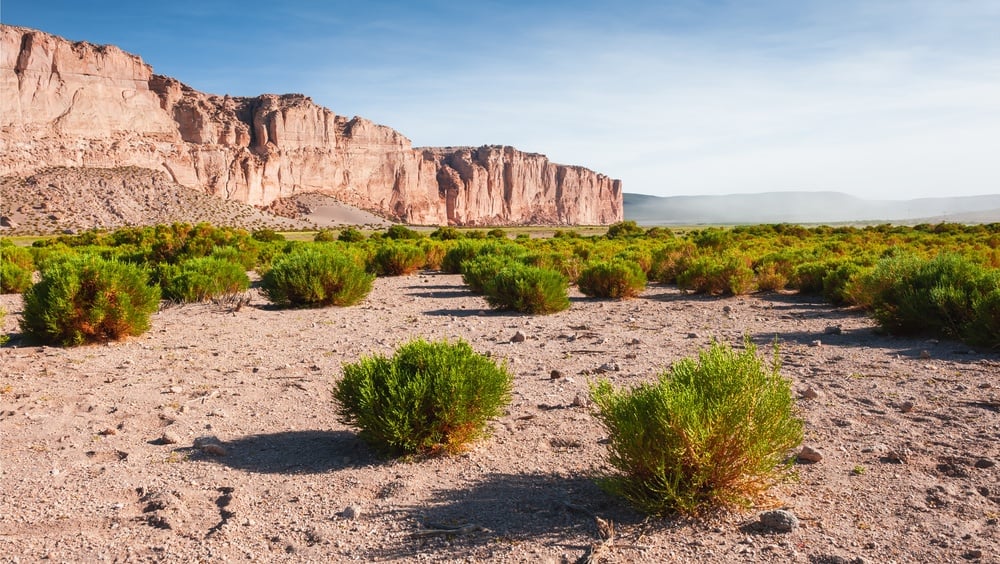
The Altiplano is described as the most extensive high plateau on Earth outside Tibet. Most of it lies in Bolivia, with northern parts in Peru, southwestern fringes in Chile and an extension into Argentina. Its average elevation is about 3,750 metres, and about 2,850,000 people lived there as of 2012.
El Alto is its largest city and La Paz the second largest, with Oruro in Bolivia and Puno and Juliaca in Peru also on the plateau. Lake Titicaca, the largest lake in South America by volume, lies on the Bolivia and Peru border, and peaks around the edge include Illimani at 6,438 metres and Illampu at 6,368 metres.
The southern end holds the Salar de Uyuni, a salt flat left behind when an ancient lake dried out. We cover how to visit it in our guide to the world’s largest salt flats.
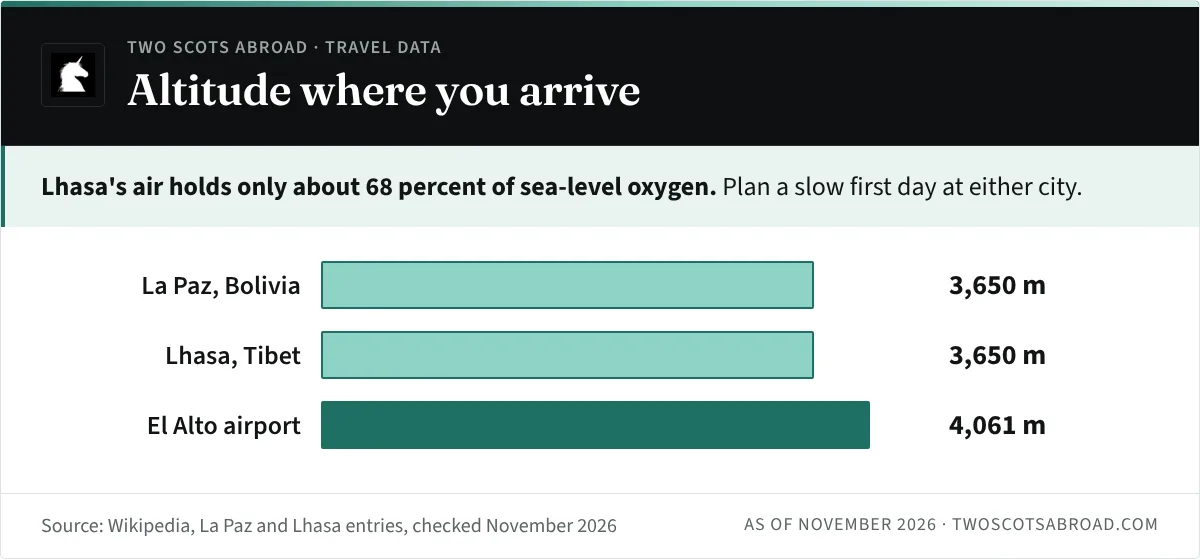
For travellers, the Altiplano is the easiest of the high plateaus to reach. La Paz sits at roughly 3,650 metres and is the highest administrative capital city in the world, and its Mi Teleférico is the largest urban cable car network. The airport in neighbouring El Alto is at 4,061 metres, and it provides oxygen for passengers who feel the altitude.
Deccan Plateau: India’s Volcanic Interior
The Deccan Plateau is much lower than the others, and it forms most of the Deccan Peninsula in India. It covers about 422,000 square kilometres across western, central and southern India, at an average elevation of about 600 metres, sloping gently from west to east. It lies mostly within Maharashtra, Telangana, Karnataka and Andhra Pradesh.
The rock is the story here. The Deccan Traps are layers of basalt more than 2 kilometres thick, laid down by lava flows around 66 million years ago, at the end of the Cretaceous. Black soil covers much of the basalt area. The Godavari, Krishna and Kaveri rivers cross it, and Bengaluru, Hyderabad and Pune all sit on the plateau.
The Deccan is the one plateau on this list where altitude is not a travel concern. Historic sites such as Hampi, Badami, Belur and the Ajanta and Ellora caves all sit on it.
Colorado Plateau: Canyon Country
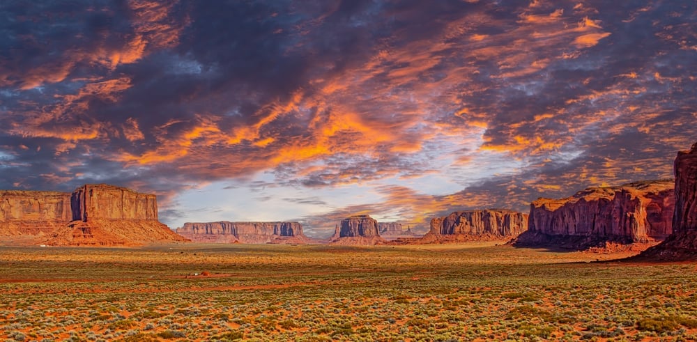
The Colorado Plateau covers about 130,000 square miles, or 340,000 square kilometres, across western Colorado, northwestern New Mexico, southern and eastern Utah, northern Arizona and a small part of southeastern Nevada. Its component plateaus range from about 4,900 to 11,000 feet (1,500 to 3,350 metres) above sea level.
It holds nine national parks: Grand Canyon, Zion, Bryce Canyon, Capitol Reef, Canyonlands, Arches, Black Canyon of the Gunnison, Mesa Verde and Petrified Forest. John Wesley Powell explored the region in 1869 and 1872. If you are planning a trip, our piece on canyons around the world covers the Grand Canyon alongside others.
Which of the World’s Biggest Plateaus Can You Visit?
Four of the five can be visited on an ordinary trip. The Antarctic Plateau needs an expedition, and the other four differ mostly in how much altitude you take on.
Lhasa and La Paz both sit at about 3,650 metres. The air in Lhasa holds only about 68 percent of the oxygen found at sea level, so plan a slow first day, and speak to a doctor before you go if you have heart or lung conditions. The Altiplano is the simplest high-altitude trip to organise, the Colorado Plateau needs a car and the Deccan needs nothing special at all.
Nights on the high plateaus are cold even when days are warm, so pack layers.

Amazon Essentials
Amazon Essentials Men's Lightweight Water-Resistant Packable Hooded Puffer Jacket, Black, Medium
ACD
We earn a commission if you buy through this link, at no extra cost to you.
If you like the idea of extreme geography, our guides to the world’s coldest cities and glaciers that are easier to visit than you might think are good next reads.
Frequently Asked Questions
What Is the Biggest Plateau in the World?
The Tibetan Plateau is the biggest high plateau, covering about 2,500,000 square kilometres at an average height above 4,500 metres. The Antarctic Plateau is also enormous, but it is covered by ice.
What Is the Highest Plateau in the World?
The Tibetan Plateau is the highest, with an average elevation above 4,500 metres and the Changtang region averaging over 5,000 metres.
What Is the Biggest Plateau in India?
The Deccan Plateau covers most of the Deccan Peninsula in India, at about 422,000 square kilometres and an average elevation of about 600 metres.
Which Plateau Is Biggest Outside Tibet?
The Altiplano in South America is described as the most extensive high plateau on Earth outside Tibet, with an average elevation of about 3,750 metres.