
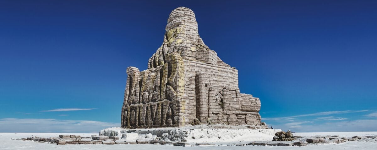
If you want the short answer to where to find the world’s largest salt flats, it’s Salar de Uyuni in southwestern Bolivia.
That answer is simple. The place itself is not. Uyuni is a high-altitude salt pan near the crest of the Andes, shaped by vanished prehistoric lakes, edged by the Bolivian Altiplano, and so flat that it has been used to calibrate satellite altimeters. After rain, it turns into an enormous mirror. In the dry season, it becomes a white geometric plain of cracked salt polygons. Either way, it hardly looks real.
And because a lot of articles stop at the postcard view, here’s the fuller version: where it is, why it’s there, what you’ll actually see, and how to visit without being surprised by the altitude, the distances, or the fact that this is a serious landscape, not just a clever photo set.
Where to find the world’s largest salt flats
The world’s largest salt flat is Salar de Uyuni, in the Daniel Campos Province of Potosí Department, in southwestern Bolivia. Most travelers reach it through the town of Uyuni, which serves as the main jumping-off point for tours across the salt pan and the wider Altiplano.
The figures vary a little depending on the source you read, but the broad consensus is clear. Salar de Uyuni covers about 10,582 square kilometers, or roughly 4,086 square miles. That’s the scale that matters.
It also sits high, at about 3,656 to 3,663 meters above sea level, which is roughly 12,000 feet. That elevation is not a small detail. It affects how you breathe, how quickly you tire, and how sensible it is to sprint off for the perfect forced-perspective photo.
Why Salar de Uyuni exists at all
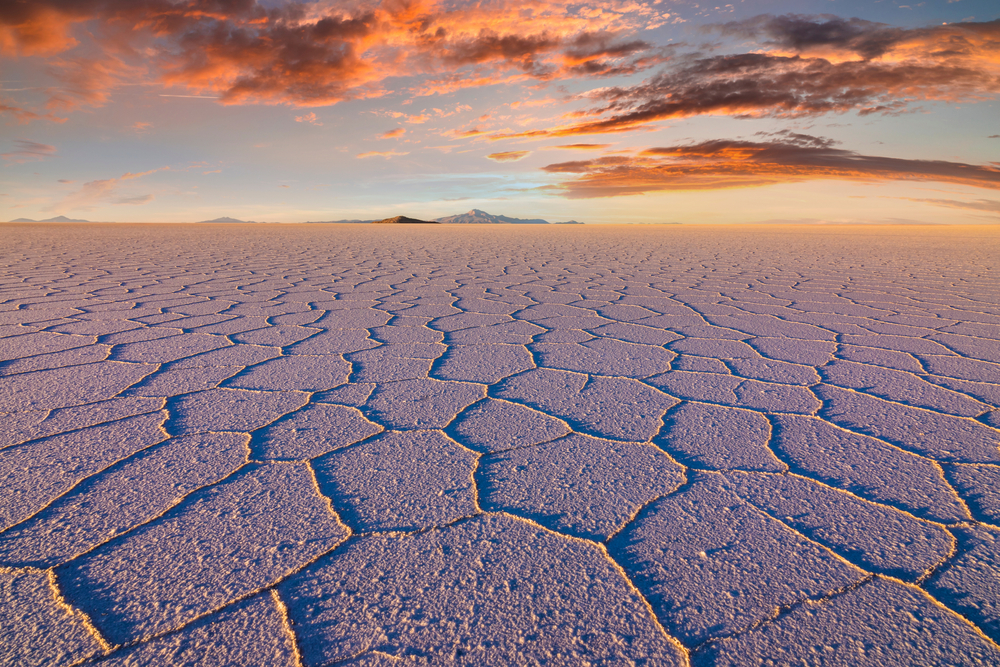
Salar de Uyuni formed from the transformation and drying of ancient lakes on the Altiplano during the Late Pleistocene. Over a very long stretch of time, water disappeared and evaporite deposits remained, leaving an immense crust of salt over brine-rich ground. Today, the surface is covered by a thick salt layer, commonly described as around eight to 10 meters deep in places.
That history is why the landscape feels so stripped down. No trees, almost no visual clutter, just mineral geometry and sky. The salt pan is the residue of water that is no longer there, which is part of what makes the place feel eerie even in full sun.
The brine beneath the crust is also rich in lithium, and the wider Uyuni area is frequently discussed in the context of global battery supply because Bolivia holds some of the planet’s largest identified lithium resources in salt-brine deposits. You’ll see that fact repeated often because it matters economically, but for a visitor the immediate reality is simpler: this is still first and foremost a fragile, high-altitude natural environment that people cross by vehicle.
What makes it different from other salt flats
Salt flats exist in many arid parts of the world. You can find famous examples in Utah, California, Peru, Argentina, India, Botswana, and Australia. If desert landscapes are your thing, you might also like these hidden mountain lakes in the USA for the exact opposite mood, less blinding white infinity, more alpine calm.
But Salar de Uyuni stands apart for three reasons.
1. Its size
It is widely recognized as the largest salt flat on Earth. That isn’t tourism copy. It’s the central fact.
2. Its extreme flatness
Uyuni is remarkably level across a huge area. The surface elevation changes by less than a meter over the salar, which is one reason Earth observation satellites have used it for calibration. Dry, bright, huge, and almost unbelievably flat is a very useful combination if you’re trying to measure things from orbit.
3. The wet-season mirror effect
After rainfall, a thin layer of still water can spread over the salt crust and turn the salar into what is often called the world’s largest mirror. This is the image that draws a lot of first-time visitors, and fair enough. It looks like the horizon has been erased.
When to visit, because season changes the whole experience
People talk about Salar de Uyuni as if it were one place with one look. It isn’t. It has two classic versions.
Wet season, roughly December to April
This is the period most associated with the mirror effect. Rainwater can create the reflective surface that makes the sky and ground merge in photographs. January and February are often the best bet for broad mirror conditions, although exact timing varies year to year with rainfall.
The trade-off is practical. Water levels and road conditions can affect routes, and some parts of the salar, including visits to Incahuasi Island, may be inaccessible at times. You may get the famous reflections, but you give up some freedom of movement.
Dry season, roughly May to November
This is when you’ll usually see the sharp hexagonal salt patterns and broad, hard white expanses under clear skies. Nights can drop well below freezing in the austral winter, especially from June to August, and early-morning departures have a way of teaching humility.
Travel across the salt flats is often more straightforward in this period, and the geometric surface is part of the appeal in its own right. If you’re the sort of traveler who checks climate patterns before you pack, pieces like Bali weather in May or St Lucia weather in April make the same basic point in a different setting: season is not decoration, it changes the trip.
So no, there isn’t a single correct answer to best time to go. If you want reflections, lean wet season. If you want the classic salt-crust texture and easier overland travel, lean dry season.

We earn a commission if you buy through this link, at no extra cost to you.
How most travelers visit Salar de Uyuni
The usual base is the town of Uyuni. From there, travelers typically choose either a one-day tour or a multi-day tour, often around three days, that extends into the surrounding southwest circuit of lagoons, geysers, desert basins, and high-altitude wildlife areas.
A day trip is enough to see the salt flats themselves and understand the scale. A longer trip is better if you want the wider Altiplano context, which matters more than many quick itineraries admit. Uyuni is part of a larger landscape system, not an isolated white attraction dropped into Bolivia by an overenthusiastic special-effects team.
Many overland routes also connect the Uyuni region with San Pedro de Atacama in Chile. That crossing is long, remote, and scenic in the stark Altiplano way: volcanoes, colored lakes, flamingos, and dust for miles. It also depends heavily on weather, road conditions, and border logistics, so this is not the place for a tightly wound schedule that falls apart the moment a vehicle is an hour late.
What to see beyond the salt itself
If you’re starting from Uyuni, a few names come up again and again because they are the standard route highlights.
Train Cemetery
Near Uyuni town, the Train Cemetery is one of the most visited stops before or after the salar proper. It’s exactly what it sounds like: rusting locomotives and rail cars left in the desert, many dating to the late 19th and early 20th centuries, when the region’s mining economy relied heavily on rail transport. Some travelers love it, some find it over-photographed and a bit scrappy, but it does say something real about the region’s mining and transport history.
Incahuasi Island
In the middle of the salt flat, Incahuasi Island is known for its giant cacti and elevated views across the white expanse. Some of those cacti are thought to be hundreds of years old, growing only a centimeter or so per year, which is a useful reminder that this place moves at geological speed, not yours. It’s one of the few places on the salar where the eye gets relief from absolute horizontality. If conditions allow your tour to stop there, take the walk. The perspective helps you understand just how vast the surrounding plain is.
Laguna Colorada and the southwest circuit
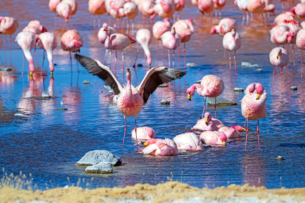
On longer tours, Laguna Colorada, often called the Red Lagoon, is a standard highlight, known for flamingos and mineral-rich color. The reddish tone comes from algae and sediments, and the lagoon sits inside the Eduardo Avaroa Andean Fauna National Reserve, where you may also see vicuñas, vizcachas, geyser fields, and a landscape that seems determined to prove beige can be dramatic. These stops are why the three-day route often feels more complete than a quick in-and-out salt-flat visit.
What the altitude actually means for visitors
At roughly 12,000 feet, Salar de Uyuni is high enough that even fit travelers can feel slow, headachy, or oddly irritated by stairs that should not be winning. That’s normal. The bigger issue is pretending it won’t happen.
Give yourself time in Bolivia before rushing into a packed itinerary if you can. Dress for strong sun and sharp temperature swings. The salar can feel hot in direct daylight and very cold once the sun drops, because high, dry plateaus are rude like that.
- Sun exposure is intense, because you’re at altitude and surrounded by reflective white salt.
- Lip balm, sunglasses, and sunscreen are not optional in any sensible packing list.
- Layers matter, especially on dawn departures and sunset stops.
- Water matters too, because dry air and long driving days catch up with people fast.

We earn a commission if you buy through this link, at no extra cost to you.
Photography is part of the culture here, but the landscape is the point
Yes, you’ll see perspective tricks with toy dinosaurs, Pringles cans, and people pretending to stand in coffee cups. Some of them are funny. A few are even good.
But the stronger reason to go is not the forced-perspective gag reel. It’s the scale, the silence, and the way the salar changes your sense of distance. In the wet season, the horizon can dissolve. In the dry season, the polygonal crust gives the ground its own abstract order. Both are memorable for reasons that have nothing to do with social media props.
If wide, slightly unnerving viewpoints are your weakness, you’ll probably also enjoy these sky-high walkways around the world. Same feeling of scale, less chance of salt in your shoes.
A quick reality check on logistics
Uyuni is remote, and that is part of the appeal. It also means you should keep your plans a little flexible. Weather changes routes. Seasonal water changes access. Altitude changes energy levels. Long drives are standard.
If you’re booking a tour, pay attention to what is actually included, whether it’s a one-day salt-flat outing or a three-day circuit through the southwest. Shared tours are common, 4×4 vehicles are standard, and accommodation on multi-day routes can be very basic, sometimes with limited heating, patchy electricity, and simple bathrooms. People regularly come back raving about the scenery and grumbling about the cold, both can be true at once.
That’s especially true if you’re comparing departures from Uyuni with overland options connected to San Pedro de Atacama. And because practical details can change, it’s wise to confirm transport schedules, tour inclusions, and local conditions shortly before you travel rather than relying on an old forum post written by someone who may or may not still think a fleece jacket counts as winter preparation.
So, where to find the world’s largest salt flats?
In southwestern Bolivia, on the high Altiplano, at Salar de Uyuni.
That’s the factual answer. The better answer is that you’ll find them in a place shaped by vanished lakes, extreme altitude, mineral wealth, and a scale that defeats ordinary travel language. A lot of landscapes are called otherworldly. Uyuni earns it, which is rarer than the adjective suggests.
If you go, choose the season for the version you actually want. Mirror or salt polygons. Reflection or geometry. Either way, Bolivia hands you one of the strangest horizons on Earth, and doesn’t need to exaggerate a thing.