
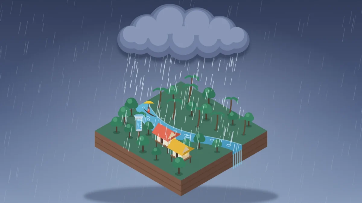
Colombia is widely ranked as the wettest country in the world, with average annual precipitation around 3,240 mm in the World Bank’s country data. Close behind are São Tomé and Príncipe, Papua New Guinea, and the Solomon Islands, all places where tropical geography keeps rainfall high for much of the year.
Quick answer:
- Wettest country in the world: Colombia, at about 3,240 mm of rain a year on average.
- Next wettest: São Tomé and Príncipe (3,200 mm), Papua New Guinea (3,142 mm) and the Solomon Islands (3,028 mm).
- Wettest place on Earth: Mawsynram in Meghalaya, India, which averages about 11,872 mm a year according to the World Meteorological Organization.
- Wettest country in Europe: Iceland, at about 1,940 mm a year. The UK averages about 1,220 mm.
- Driest country: Egypt, at just 18 mm a year.
- Country figures come from the World Bank’s average precipitation data (latest year 2022), checked in October 2026.
That does not mean every corner of those countries is soaked every day. Country-level rainfall averages smooth out huge regional differences, especially in places with mountains, trade winds, monsoon patterns, and long coastlines.
If you are searching for the Rainiest Countries in the World, the most useful approach is to look at both the ranking and the climate logic behind it. Wet countries tend to cluster near the equator, inside or near the Intertropical Convergence Zone, where warm air, ocean moisture, and frequent storm formation do a lot of the work.
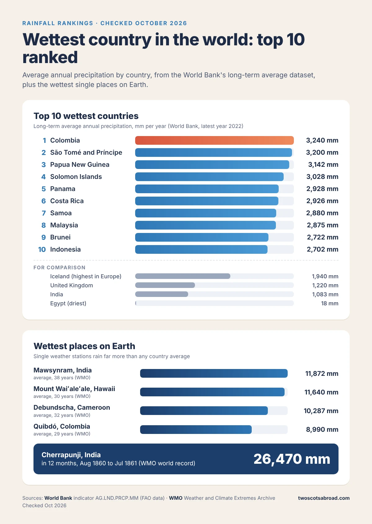
Top 10 Wettest Countries in the World
The list below uses the World Bank’s average precipitation in depth indicator, which gives each country’s long-term average annual precipitation in millimeters, based on data from the UN Food and Agriculture Organization. The latest year listed is 2022, and because it is a long-term average, the figure stays the same from year to year.
| Rank | Country | Region | Average Annual Precipitation |
|---|---|---|---|
| 1 | Colombia | South America | 3,240 mm |
| 2 | São Tomé and Príncipe | Central Africa (Gulf of Guinea) | 3,200 mm |
| 3 | Papua New Guinea | Oceania | 3,142 mm |
| 4 | Solomon Islands | Oceania | 3,028 mm |
| 5 | Panama | Central America | 2,928 mm |
| 6 | Costa Rica | Central America | 2,926 mm |
| 7 | Samoa | Oceania | 2,880 mm |
| 8 | Malaysia | Southeast Asia | 2,875 mm |
| 9 | Brunei | Southeast Asia | 2,722 mm |
| 10 | Indonesia | Southeast Asia | 2,702 mm |
These figures are typically presented as long-term country averages, usually in millimeters per year. The exact ordering can shift a little depending on the dataset and reference year, but Colombia appears at or near the top in the most commonly cited rankings.
If you want to save or share the ranking, here it is in one image:
Just outside the top 10 are Bangladesh (2,666 mm), Fiji (2,592 mm), Sierra Leone (2,526 mm), Singapore (2,497 mm), and Liberia (2,391 mm).
Use a different dataset and the order changes, which is why you will see slightly different lists online. The World Bank’s Climate Change Knowledge Portal, which uses gridded CRU weather observations for 1991 to 2020, puts Brunei top at about 3,262 mm, followed by the Solomon Islands and Samoa, with Colombia at about 2,567 mm. Both are World Bank sources. They simply measure in different ways over different periods, so the takeaway is that the top few countries are very close, and Colombia leads on the long-term average used in the table above.
Why These Countries Get So Much Rain
Most of the wettest countries sit in the tropics, especially in Southeast Asia, the South Pacific, Central America, and the northern part of South America. That pattern is not random.
The biggest driver is proximity to the equator. Warm air rises quickly in equatorial zones, and when it is packed with ocean moisture, heavy rainfall follows. Many of these countries also lie in or near the Intertropical Convergence Zone, where trade winds from the Northern and Southern Hemispheres meet and help trigger frequent storms.
Then there is topography. In Colombia, the Andes and the Pacific side help create very wet zones, especially around Chocó, where annual totals can climb far beyond the national average. In Papua New Guinea, the Highlands and exposure to major wind systems keep rainfall elevated across large parts of the country. In island nations such as Samoa and the Solomon Islands, warm surrounding seas keep the atmosphere humid and unstable.
Monsoon seasons also matter. In countries such as Indonesia and Malaysia, seasonal wind shifts bring sustained, intense rains over a period of months rather than just short tropical bursts. That overlap between rainfall and sticky air is one reason this list sits close to places featured in our guide to the most humid countries in the world.
What the Ranking Does and Does Not Mean
A list of the rainiest countries is useful, but it can also be a little misleading if you take it too literally. A country average tells you the broad climate story. It does not tell you what the weather will be like in every city, on every coast, or in every season.
Colombia is the obvious example. It is ranked first overall, but parts of the country are much drier than the wettest Pacific and Andean zones. The same goes for Panama, Costa Rica, and Indonesia, where one region can feel relentlessly wet while another has a pronounced dry spell.
Country size also affects the rankings. Smaller tropical island nations can post very high national averages because there is less internal climate variation. Large countries often have enough dry territory to pull the average down, even when some regions are drenched.
Closer Look at the Wettest Countries
Colombia
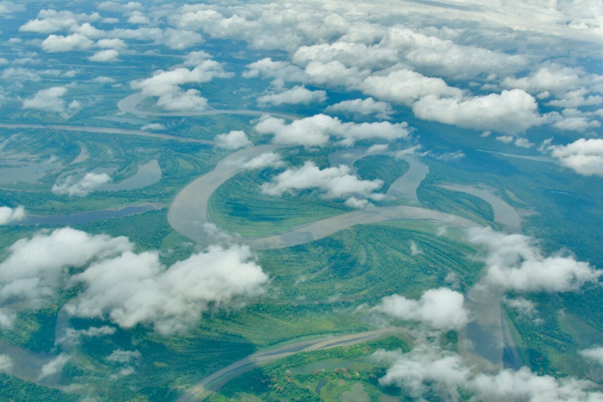
Colombia leads the global ranking at about 3,240 mm per year. Its wettest areas are commonly linked to the Pacific coast and parts of the Andean interior, where elevation changes and moist airflows combine to produce frequent rainfall. Quibdó, the capital of Chocó, holds the official South American record for average rainfall, at 8,990 mm a year.
It is also one of the clearest reminders that rain and heat are not the same thing. Climate conditions vary sharply by altitude, so you can move from tropical lowlands to much cooler highland weather within the same country.
São Tomé and Príncipe
This small island nation off the coast of West Africa averages around 3,200 mm of rain annually. Reports on its climate often describe a long rainy stretch running from September to May, which is a lot of calendar space to dedicate to umbrellas.
Its location in the Gulf of Guinea and tropical maritime setting keep humidity and rainfall levels high.
Papua New Guinea
Papua New Guinea averages roughly 3,142 mm per year. Rainfall patterns are shaped by southeast trade winds, a northwesterly turbulence zone, rugged terrain, and altitude differences.
In practical terms, seasons here are often understood more by rainfall than by temperature. That can sound manageable on paper, then your plans get rearranged by a washed-out road or a domestic flight delay.
Solomon Islands
The Solomon Islands receive about 3,028 mm annually. In many parts of the country, the main rainy season runs from November to April, when a large share of the yearly total falls.
Some southern island areas also see particularly wet conditions later in the year, which shows how regional patterns can remain messy even inside a small island country.
Panama and Costa Rica
These two Central American countries are almost tied, with Panama at 2,928 mm and Costa Rica at 2,926 mm. Both are influenced by tropical seas, mountain barriers, and wet Caribbean-facing slopes.
If you have ever planned a trip to either country and found yourself reading five different versions of the rainy season, that is why. Local geography changes the forecast fast. Our 2-week Costa Rica itinerary deals with exactly this, because the Pacific and Caribbean coasts follow different rainfall patterns.
Wettest Country in the World vs the Wettest Place on Earth
Here is where a lot of searches get tangled. The wettest country is an average across a whole nation. The wettest place is a single weather station, and those numbers are in a different league.
The World Meteorological Organization’s table of weather and climate records lists Mawsynram, in the Meghalaya hills of northeast India, as the wettest place in Asia, with an average of 11,872 mm a year over 38 years. That is more than three and a half times Colombia’s national average. Yet India as a whole averages only about 1,083 mm, which is why it is nowhere near the top 10 countries.
| Place | Country | Average Annual Rainfall | Notes |
|---|---|---|---|
| Mawsynram | India | 11,872 mm | 38-year average, WMO record for Asia |
| Mount Waiʻaleʻale, Kauai | United States (Hawaii) | 11,640 mm | 30-year average, WMO record for the South-West Pacific |
| Debundscha | Cameroon | 10,287 mm | 32-year average, WMO record for Africa |
| Quibdó | Colombia | 8,990 mm | 29-year average, WMO record for South America |
| Lloró | Colombia | about 13,300 mm | Estimate only, not an official record |
| Crkvice | Montenegro | 4,593 mm | 1961 to 1990 average, WMO record for Europe |
Cherrapunji (also called Sohra), just along the hills from Mawsynram, holds the world record for the most rain in 12 months: 26,470 mm between August 1860 and July 1861. It also holds the 48-hour record, with 2,493 mm on 15 and 16 June 1995.
You may also see Lloró, in Colombia’s Chocó region, called the wettest place on Earth. Its average of about 13,300 mm is an estimate, so the official South American record goes to nearby Quibdó instead. Either way, it helps explain why Colombia sits at the top of the country list.
Mount Waiʻaleʻale on Kauai is the one most visitors can actually get close to, and Kauai helicopter tours are the usual way to see its rain-fed interior, weather permitting.
Why So Many Rainiest Countries Are Islands
A striking number of countries on the list are islands or archipelagos, including Samoa, the Solomon Islands, São Tomé and Príncipe, Brunei on Borneo, Indonesia, and Papua New Guinea. Warm ocean water provides a steady moisture source, and marine air masses do not need much encouragement to turn into heavy rain.
That is also why wet countries often overlap with very humid ones, though the two are not identical. If you want that comparison, our guides to the most humid countries in the world and which countries have the shortest coastlines help show how coastline exposure, island geography, and atmospheric moisture shape national climate patterns.

We earn a commission if you buy through this link, at no extra cost to you.
How Rainiest Countries Compare With Europe and the Middle East
The wettest countries overall are mostly outside Europe. One commonly cited European example is Iceland, with average annual precipitation around 1,940 mm, the highest of any European country in the World Bank data. That is rainy by European standards, but still far below the top tropical countries on the global list.
Next in Europe come Switzerland (1,537 mm), Albania (1,485 mm), and Norway (1,414 mm). The United Kingdom averages about 1,220 mm, and Ireland about 1,118 mm.
If you are wondering about Scotland: no, it is not the wettest country in the world, although it does its best. Met Office figures put Scotland’s average at about 1,573 mm a year for 1991 to 2020, roughly half of Colombia’s total, and the wet west gets far more than the drier east. Our piece on Scotland’s sunniest town and gloomiest village shows how big that gap can be.
The wettest single spot in Europe is Crkvice in Montenegro, with a WMO-listed average of 4,593 mm a year for 1961 to 1990.
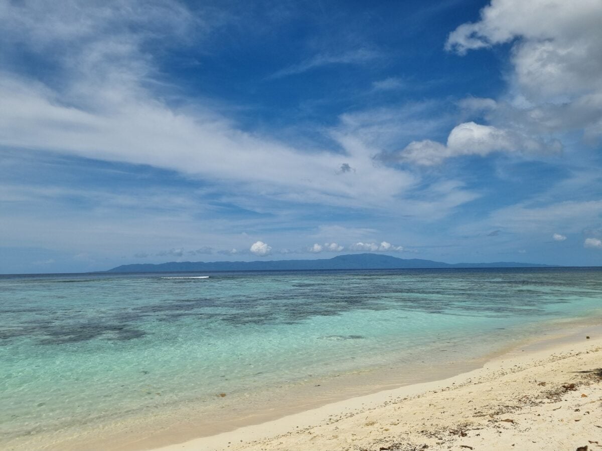
At the other extreme, countries such as Egypt, the United Arab Emirates, Oman, and Algeria are regularly mentioned among the driest. The contrast makes the tropical rainfall belt look even more dramatic.
In the same World Bank data, Egypt is the driest country of all, averaging just 18 mm a year, followed by Libya (56 mm) and Saudi Arabia (59 mm).
Are the Rainiest Countries Also Good for Agriculture?
Often yes, but only up to a point. Reliable rainfall supports farming, water supplies, forests, and hydrology, especially in countries where agriculture remains a major part of the economy.
Too much rain can also bring floods, landslides, transport problems, crop losses, and difficult sanitation conditions. So a very wet climate is not automatically an agricultural jackpot. It is more accurate to say that predictable rainfall is useful, while extreme or poorly timed rainfall can be expensive and disruptive.
How To Use This Ranking If You Are Planning Travel
If you are using the Rainiest Countries in the World list for trip planning, treat it as a starting point, not the final answer.
- Check the specific region. Western Colombia and highland Colombia are not the same forecast.
- Look at the season. In the Solomon Islands, November to April is especially wet in many areas.
- Time the monsoon. For Malaysia and Indonesia, our guide to the best time to visit Southeast Asia breaks the wetter and drier months down by country.
- Expect humidity. In equatorial island climates, rain often arrives with sticky air and quick-changing skies.
- Pack for repeated showers, not just one dramatic thunderstorm. Quick-dry clothing usually works better than anything heavy.
For people comparing climates more broadly, this article also pairs well with our pieces on the hottest countries in the world, Bali weather in May, and the least humid countries in the world. And if all this rain has you craving a dry spell, here are the countries with the best weather year-round.
FAQ About the Rainiest Countries in the World
What Is the Wettest Country in the World?
Colombia is most often ranked as the rainiest country in the world, with average annual precipitation of about 3,240 mm. That is the World Bank’s long-term average, and it puts Colombia just ahead of São Tomé and Príncipe at 3,200 mm.
What Is the Wettest Place on Earth?
Mawsynram in Meghalaya, India, is usually named the wettest place on Earth, averaging about 11,872 mm of rain a year according to the WMO. Nearby Cherrapunji holds the record for a single 12-month period, with 26,470 mm in 1860 to 1861.
What Is the Wettest Country in Europe?
Iceland is the wettest European country in the World Bank data, averaging about 1,940 mm a year. The wettest single place in Europe is Crkvice in Montenegro, at about 4,593 mm.
Is the UK or Scotland the Wettest Country in the World?
No. The UK averages about 1,220 mm a year and Scotland about 1,573 mm, which is less than half of Colombia’s total. It just feels that way on the west coast in November.
What Is the Wettest Country in Africa?
São Tomé and Príncipe, the small island nation in the Gulf of Guinea, at about 3,200 mm a year. On the mainland, Sierra Leone (2,526 mm) and Liberia (2,391 mm) are the wettest.
What Is the Driest Country in the World?
Egypt is the driest country in the World Bank data, averaging just 18 mm of precipitation a year.
Which Continents Have the Wettest Countries?
The wettest countries are concentrated in South America, Asia, Oceania, and parts of Central America and Africa, especially in tropical and equatorial zones.
Is the Rainiest Country Also the Most Humid?
Not necessarily. Rainfall and humidity are related, but they are different measures. A place can be very wet overall without feeling equally humid all the time, and the reverse can also happen.
Why Are So Many Rainiest Countries Near the Equator?
Equatorial regions receive strong solar heating, frequent rising air, and abundant ocean moisture. The Intertropical Convergence Zone adds even more storm activity in many of those areas.
Do Small Island Countries Rank Higher Than Big Countries?
They often do, because a small tropical island nation can maintain a very high rainfall average across most of its land area. Large countries usually include more climate variation, which lowers the national average.
Final Word
The Rainiest Countries in the World are mostly tropical, ocean-influenced, and close to the equator. Colombia, São Tomé and Príncipe, Papua New Guinea, and the Solomon Islands lead the pack, while Panama, Costa Rica, Samoa, Malaysia, Brunei, and Indonesia round out a top 10 shaped by warm seas, mountain barriers, and monsoon systems.
If you only remember one thing, make it this: a country can rank among the wettest on Earth and still contain dry pockets, clear seasons, and very different local climates. Rainfall maps are useful. They are just not the whole weather story.