

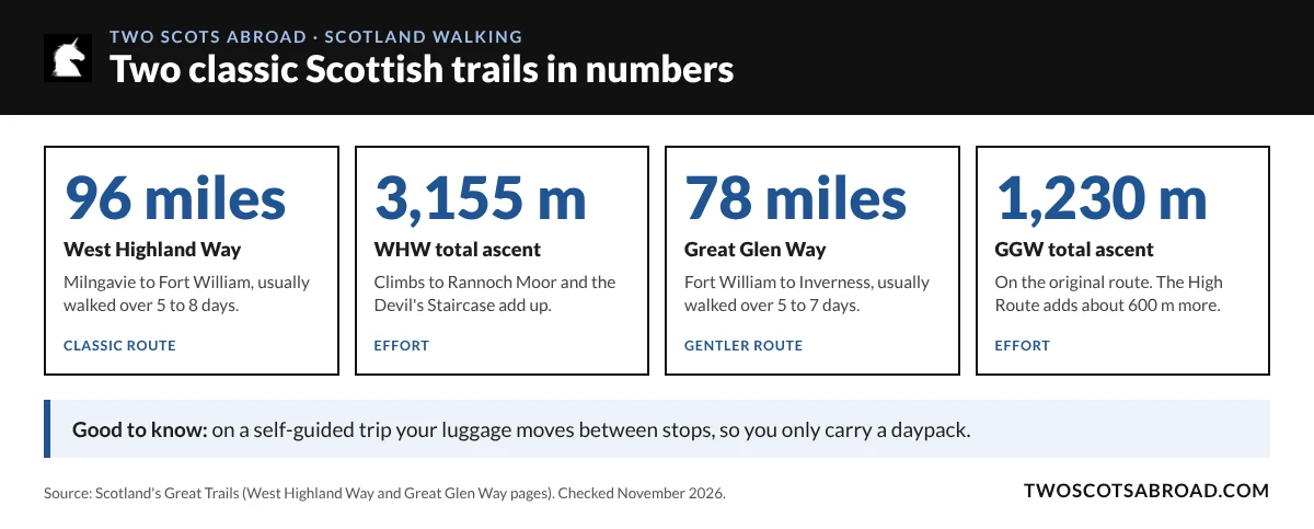
Self-guided walking holidays in Scotland let you spend a week on foot without hauling a heavy rucksack up a glen every morning. The West Highland Way alone runs 154 km (96 miles) from Milngavie to Fort William, so choosing the right trail matters.
Here’s how self-guided trips work, what each of the three big options asks of your legs (the West Highland Way, the Great Glen Way and the Isle of Skye), how to organise it, when to go and how to get there, and what to pack.
What Is a Self-Guided Walking Holiday?
On a self-guided trip, a company books your accommodation and plans the stages, then you walk at your own pace without a guide. Many also move your luggage between overnight stops, so you only carry a daypack with waterproofs, water and snacks.
You still need to be comfortable reading a route, coping with Scottish weather and covering the day’s distance under your own steam. What you skip is the planning, the booking and the heavy bag.
Which Scottish Trail Suits You?
| Feature | West Highland Way | Great Glen Way | Isle of Skye |
|---|---|---|---|
| Distance | 96 miles (154 km) | 78 miles (125 km) | Varies by route |
| Typical length | 5 to 8 days | 5 to 7 days | Varies by itinerary |
| Terrain | Loch shores, moorland and old military roads | Canal towpath and forest tracks, with a higher option | Rocky coast and rough hill paths |
| Best for | Big mountain scenery | A gentler pace | Walkers who want drama and don’t mind the weather |

The West Highland Way Gives You the Big Scenery
The West Highland Way is Scotland’s classic long-distance walk, running 96 miles from Milngavie, on the edge of Glasgow, to Fort William. Most walkers take five to eight days, but you don’t need to walk all of it: a section still gets you the views.
The early days are the gentlest. You reach Loch Lomond early on and follow its shore north. Then the landscape opens out across Rannoch Moor and through Glencoe, the weather becomes more changeable, and Ben Nevis appears ahead as you near Fort William.
Not every stage on the official route makes a comfortable single day, and a self-guided plan can split the longer ones to suit you. For a rough idea of how to divide it, see this West Highland Way itinerary.
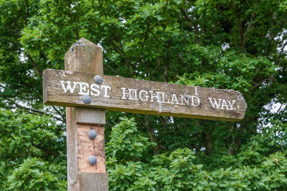
The official route splits into eight sections. Here’s how they break down, from the West Highland Way’s own route pages:
| Section | Distance | What to expect |
|---|---|---|
| Milngavie to Drymen | 12 miles | Gentle farmland, woods and old railway line |
| Drymen to Rowardennan | 15 miles | Conic Hill, then the first views along Loch Lomond |
| Rowardennan to Inverarnan | 14 miles | Rough, rocky path along the loch shore |
| Inverarnan to Tyndrum | 12 miles | Glen Falloch and the climb into Strath Fillan |
| Tyndrum to Inveroran | 9 miles | Old military road past Bridge of Orchy |
| Inveroran to Kingshouse | 10 miles | Across the edge of Rannoch Moor |
| Kingshouse to Kinlochleven | 9 miles | Up the Devil’s Staircase, then a long descent |
| Kinlochleven to Fort William | 15 miles | The Lairig Mor pass and views of Ben Nevis |
Rowardennan to Inverarnan is slower than its mileage suggests, because the loch-shore path is rough and rocky in places. If you’re short on time, Kinlochleven to Fort William makes a fine one-day taste of the route.
Two practical points for the Loch Lomond stretch. From 1 March to 30 September, the camping byelaws on East Loch Lomond mean camping is only allowed in campsites and designated permit areas. And if you’re walking with a dog, the enclosed fields on the approach to Conic Hill are closed to dogs during lambing, typically from mid-April to the end of May, so follow the signed alternative.
This map shows the full route:
The Great Glen Way Is the Kinder Choice
The Great Glen Way crosses the country from Fort William to Inverness. It’s shorter, at 78 miles, and most people take five to seven days. It follows the Caledonian Canal past Loch Lochy and Loch Oich, then runs along Loch Ness.
The opening stages are mostly flat towpath, which is rare for a Scottish long-distance trail and makes for an easy start if your knees have their own opinions about the trip. At Neptune’s Staircase, the flight of locks near the start, you get a last look back at Ben Nevis.
Later on, you can choose between the original lower route and the High Route above Loch Ness. The High Route adds roughly 600 m of climbing and tops out at 422 m between Invermoriston and Drumnadrochit, with big views over the loch.
Highland Council’s suggested six-day plan splits the walk like this:
| Day | Stage | Distance |
|---|---|---|
| 1 | Fort William to Gairlochy | 10.6 miles |
| 2 | Gairlochy to South Laggan | 12.8 miles |
| 3 | South Laggan to Fort Augustus | 12.1 miles |
| 4 | Fort Augustus to Invermoriston | 9.2 miles |
| 5 | Invermoriston to Drumnadrochit | 14.3 miles |
| 6 | Drumnadrochit to Inverness | 19.9 miles |
The last day into Inverness is the longest, so some walkers split it with an extra night. Highland Council’s Great Glen Way pages describe each section, including the Invergarry Link, an alternative for walkers staying overnight in Invergarry.
Skye Is for Walkers Who Like a Bit of Drama
The Isle of Skye is all rock, sea lochs and jagged ridges. It’s the most remote and exposed of the three, with weather that can change fast, but it’s also the most otherworldly.
It suits couples who are happy to carry waterproofs every day and adjust a walk when the cloud comes down. Popular spots such as the Fairy Pools walking route draw crowds in summer, while longer coastal walks feel far more remote.
The best-known long route is the unofficial Skye Trail, an 80-mile (128 km) route from Rubha Hunish at the island’s northern tip to Broadford in the south. It isn’t waymarked, crosses pathless ground in places and follows the Trotternish Ridge, so it suits experienced walkers who can navigate.
| Skye Trail stage | Distance |
|---|---|
| Rubha Hunish to Flodigarry | 11.5 km |
| Flodigarry to the Storr | 28.5 km |
| The Storr to Portree | 14 km |
| Portree to Sligachan | 19 km |
| Sligachan to Elgol | 18 km |
| Elgol to Torrin | 16.5 km |
| Torrin to Broadford | 20 km |
Self-guided Skye holidays don’t have to follow it. Many mix shorter coastal and hill walks from a few bases, which leaves room to swap days when the weather turns. Ask any operator which sections are pathless, and what the bad-weather alternative is for each day.
Use the matcher below to see which trail fits how you like to walk.
 Which Scottish Trail Suits You?
Answer four questions about your walking style. The matcher suggests the Scottish trail that fits best and what to plan for.
Your best match
Plan for
How Do You Organise It Without the Heavy Lifting?
Walking holidays in Scotland from Orbis Ways are self-guided, so you walk at your own pace while your luggage is moved on to the next night’s stop. The company lists luggage transfers, handpicked accommodation and 24/7 travel assistance among its features.
Orbis Ways sells the West Highland Way in more than one version, along with the Great Glen Way and an Isle of Skye walk, so you can match the trip length and route to your fitness and the time you have. Check what’s included in your quote, such as the number of nights, luggage limits and how to reach help on the trail.
Phone signal can be patchy in the Highlands, so download route maps and booking details before you set off. This guide to staying connected on a Scotland road trip covers what to sort before you go.
When Is the Best Time for a Walking Holiday in Scotland?
Most self-guided walking trips run from spring to early autumn. Each part of the season has trade-offs:
- April and May: lighter evenings and fewer midges, though it can still be cold on high ground. Lambing restrictions affect dog walkers on parts of the West Highland Way.
- June to August: the longest days and busiest trails. Accommodation fills early, and midges peak in July and August, especially on the west coast.
- September and October: autumn colours and quieter paths, with shorter days and more changeable weather as the season goes on.
Winter walking on these routes is a different undertaking, with short daylight hours, snow on the high ground and many places to stay closed, so most self-guided trips aren’t sold then.
How Do You Get to the Start and Back From the Finish?
All three walks work without a car. According to Scotland’s Great Trails, Milngavie is a short train ride from Glasgow Queen Street, and Fort William has trains on the West Highland Line and Scottish Citylink buses back to Glasgow.
The Great Glen Way links two well-connected towns, as Fort William and Inverness both have rail and long-distance bus services. On Skye, Broadford and Portree have bus connections, including Citylink coaches to Glasgow and Inverness, but check timetables before you rely on a bus for the last leg of the day.
How Fit Do You Need to Be?
You don’t need to be an athlete, but you do need to walk day after day. Stages of 10 to 15 miles on rough ground can take most of a day once you add stops, and the hardest part is often getting up and doing it again tomorrow.
In the weeks before you go, build up to back-to-back walks of the length you’re planning, ideally in the boots and with the daypack you’ll use. If you’ve never walked more than a couple of days in a row, the Great Glen Way or a shortened West Highland Way is a gentler first trip.
How Do You Stay Safe on Scotland’s Long-Distance Trails?
Both the West Highland Way and the Great Glen Way are waymarked, but the weather still makes the rules. Check the Mountain Weather Information Service forecast for the West Highlands before high or exposed sections, carry a map or offline route, and tell your accommodation if you change your plans.
Follow the Scottish Outdoor Access Code when you pass through farmland, close gates behind you and keep dogs under close control near livestock. In an emergency, call 999 or 112 and ask for the police, then mountain rescue.
What Should You Pack for a Scottish Walking Holiday?
| Item | Why it matters |
|---|---|
| Waterproof jacket and trousers | Rain can arrive at any time of year |
| Thin layers | Temperatures change quickly with height, wind and cloud |
| Broken-in walking boots | Blisters can ruin a multi-day walk |
| Midge repellent and head net | Midges are worst from late May to September, especially in the west |
| Offline maps and route notes | Signal is unreliable in remote glens |
Unless you’re walking in winter, take midge repellent. This guide to the worst places for midges in Scotland explains where they’re at their most persistent.
Self-Guided Walking in Scotland FAQ
How long does the West Highland Way take?
Most walkers take five to eight days for the full 96 miles from Milngavie to Fort William.
Is the Great Glen Way easier than the West Highland Way?
Generally, yes. It’s shorter at 78 miles, starts on a flat canal towpath and has less climbing on its original route, though the optional High Route adds more.
Do I carry my own luggage on a self-guided walk?
Not if your trip includes luggage transfer. Your main bag is moved between overnight stops, and you carry a daypack.
When is midge season in Scotland?
Roughly late May to September, with July and August usually the worst, especially on the west coast.
Can you walk the West Highland Way with a dog?
Yes, but dogs must be under close control around livestock, and the fields on the approach to Conic Hill are closed to dogs during lambing, typically mid-April to the end of May. Check that your accommodation accepts dogs too.
Is the Skye Trail waymarked?
No. It’s an unofficial, unwaymarked route that crosses pathless ground in places, so it suits experienced walkers who can navigate.
Which Scottish walk is best for beginners?
The Great Glen Way is often the easiest introduction thanks to its gentle start, but any route can be shortened to suit you.
Pick the trail that matches your legs and your patience with the weather, let someone else carry the bags, and leave room in the plan for a slow lunch by a loch.